Now that Spring is on its way, the weather should encourage us to make more use of bridleways and footpaths. Around 150 walk descriptions are available to download free from our website. As well as saying when to turn left or right, our route descriptions aim to point out things of interest along the way. Some of these will be marked on the local Ordnance Survey map.
Ordnance Survey (“OS”) has been the UK’s official mapping body since 1791 AD, having originated for military purposes. Its activities have left various physical markers which may still be encountered, albeit that mapping techniques have moved forward in recent times with the satellite-based GPS (global positioning system).
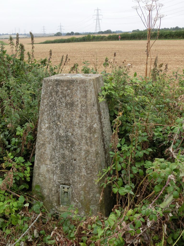
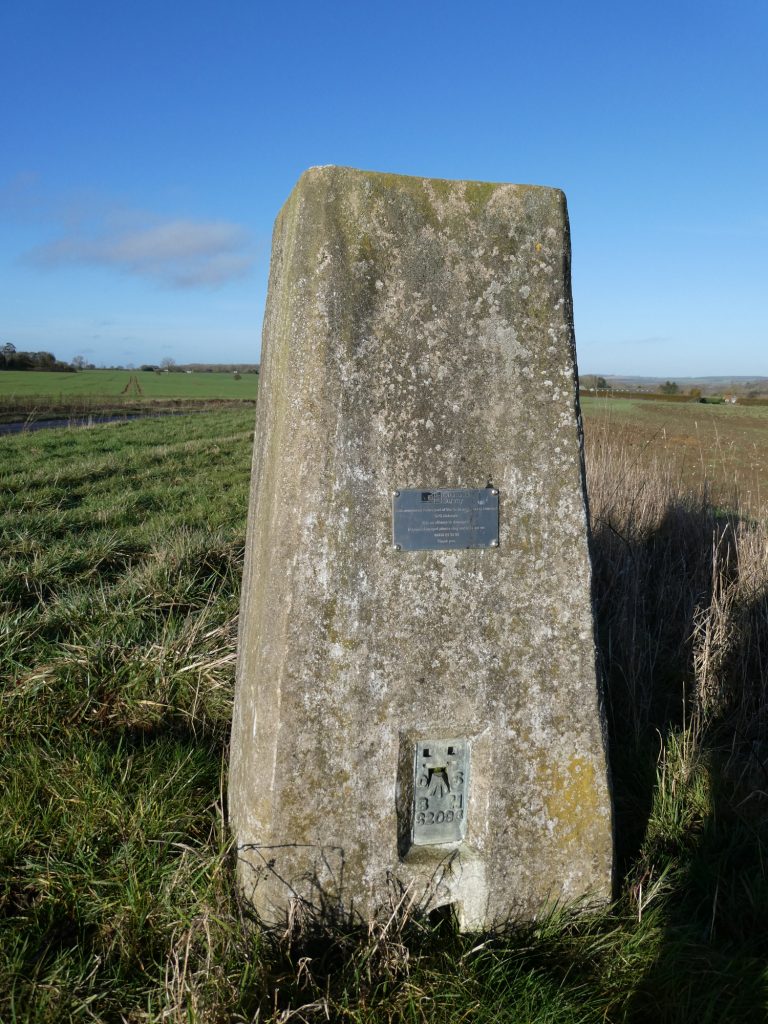
The two historic OS markers that are most likely to be encountered are “triangulation pillars” and “benchmarks”. Several thousand triangulation pillars (also referred to as trig points) were installed all over the UK – solid concrete pillars about 4 feet tall, usually erected at a high point with a clear range of vision. Each has a place on top for positioning a map measurer’s tool, a theodolite. The pillar’s location and height above sea level have been precisely measured and recorded so that from here the map maker can plot the surrounding landscape.
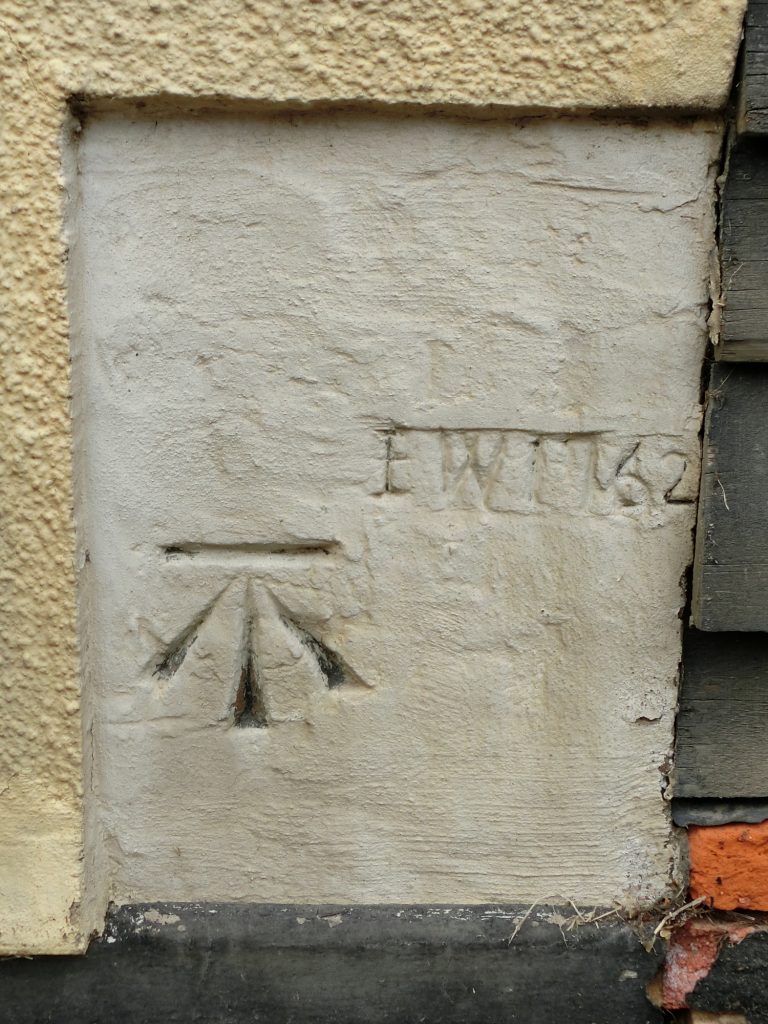
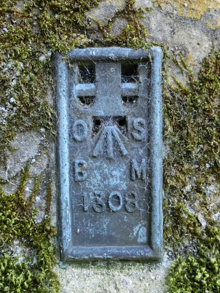
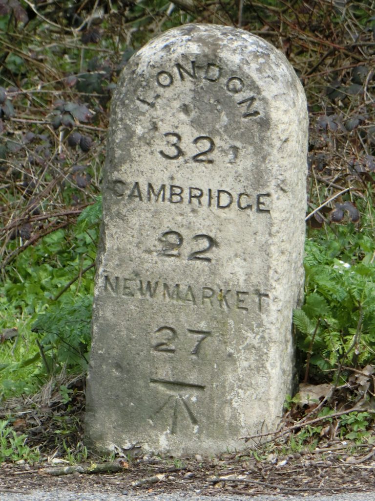
OS surveyors also left “benchmarks” in thousands of strategic locations. These are additional altitude reference points, a horizontal line indicating height above sea level – chiselled into a wall or milestone from around 1840 until the 1990s. The benchmark was sometimes indicated on a brass plaque attached at the appropriate height. On OS benchmarks, the horizontal line appears above an upward-pointing arrow.
Please look out for trig points and benchmarks. If they are on a Hundred Parishes walk route but
not yet mentioned in the description, please let us know.